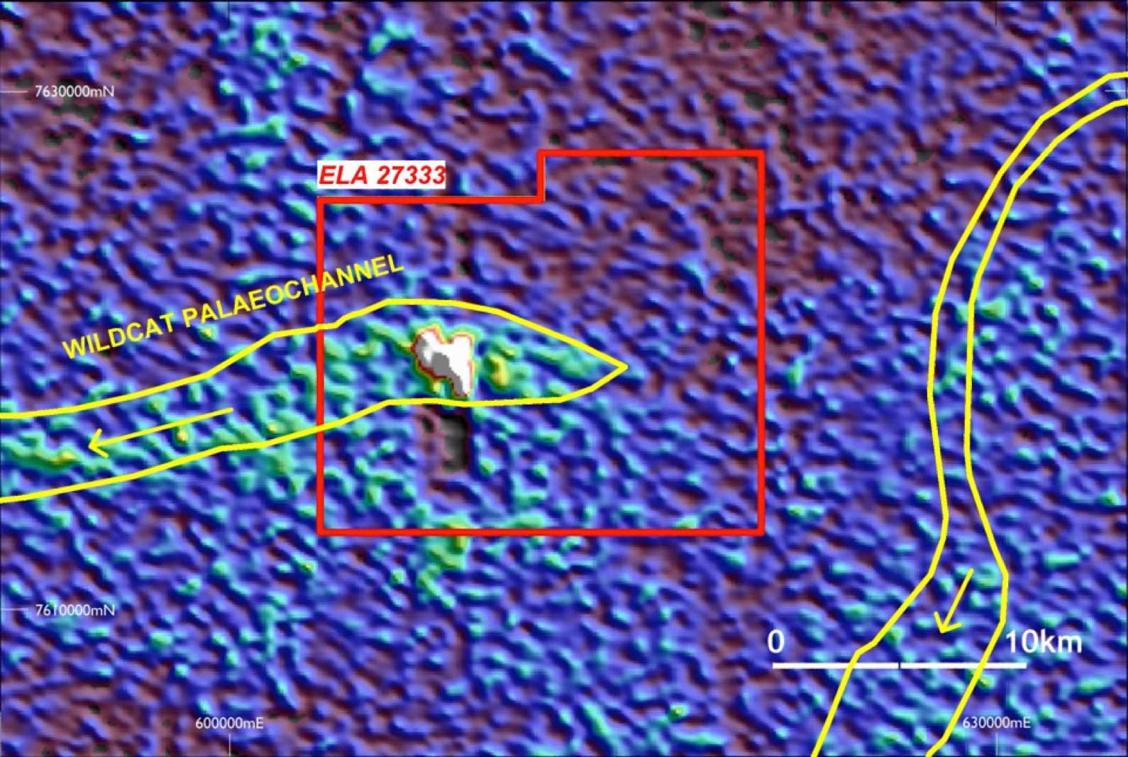
The Macallan project comprises a single exploration licence application (ELA27333), located 460 km NW of Alice Springs and 140 km from Bigrlyi. The tenement (area 225 km²) was applied for to cover a strong 3km-wide bullseye radiometric anomaly identified through the interpretation of regional airborne geophysical data. The anomaly, which lies within the Tanami Desert, occurs in an area dominated by extensive sand plain, dune and sheet wash cover. A recent interpretation of palaeovalley systems within central Australia by Geoscience Australia indicates that the Macallan anomaly lies within the Wildcat Palaeovalley, an ancient valley system that drains into Lake Mackay to the southwest. Energy Metals considers that the Macallan anomaly most likely represents a surficial accumulation of uranium minerals associated with the Wildcat palaeodrainage system; though other explanations are possible.
ELA27333 lies on land under Aboriginal Freehold title and access is subject to negotiation with the Traditional Owners and the CLC. A draft exploration access deed from the CLC is currently under consideration and if agreement can be reached, access to evaluate the anomaly may be possible in the near term.