The Lakeside project is located 20km west of Cue, within the Yilgarn region of WA and comprises a surficial-style uranium mineralised system hosted in calcrete and calcareous sediments within a palaeochannel and saline drainage system at shallow depths (typically less than 7m below surface). The project comprises a Retention Licence (R21/1) that covers resource areas. An initial resource estimate of 270 tonnes U3O8 at an average grade of 400 ppm U3O8 at a cut-off grade of 200ppm U3O8 was previously reported for the Lakeside deposit under the JORC (1996) code.
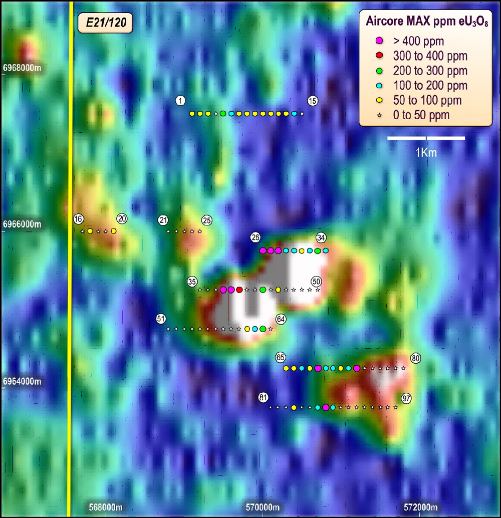
Aircore and auger drilling campaigns completed by EME in the period 2007 to 2014 identified uranium mineralisation of sufficient continuity and tenor to allow an update of the earlier resource estimate. In June 2014, a new resource estimate, representing an increase of 256% over the previous estimate, was completed (see table below).
| Tonnes(Million) | Cut-off Grade U3O8 (ppm) | Average Grade U3O8 (ppm) | Contained U3O8 (tonnes) | Contained U3O8 (Mlb) |
| 2.74 | 200 | 350 | 960 | 2.12 |
| 5.02 | 100 | 257 | 1289 | 2.84 |
The Mineral Resources have been classified & reported in accordance with JORC (2012) requirements. The resource classification is based on the assessed level of confidence in sample methods used, geological interpretation, drill spacing & geostatistical measures.
Uranium mineralisation was found to be distributed in three different domains which are interpreted as separate palaeochannels, North, Central and South (see figure below). The uranium distribution is concentrated within the central palaeochannel which holds 75% of the resource at 200ppm U3O8 cut-off.
A Hychips spectral mineralogical study indicates that the Lakeside uranium mineralisation is most closely associated with the interface between upper saponitic clay and/or dolomite-rich (dolocrete) units and an underlying kaolinitic clay rich unit. The best uranium grades correlate with areas where the kaolinitic clay rich unit is thickest, and these correspond, in particular, to the axis of the central palaeochannel.
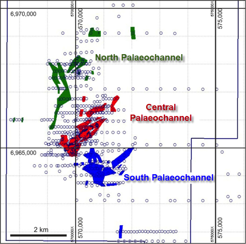
Plan of the Lakeside deposit showing the historical and EME drill hole collar distribution (circles) and the mineralised palaeochannel domains.